The APB is improving the management of its ports with geospatial technology
The port authority is unifying its ICT systems and implementing a system based on smart maps
Palma
15/04/2024
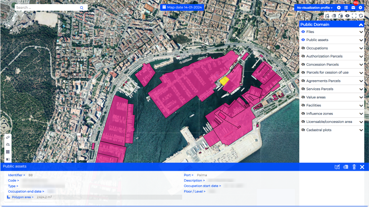
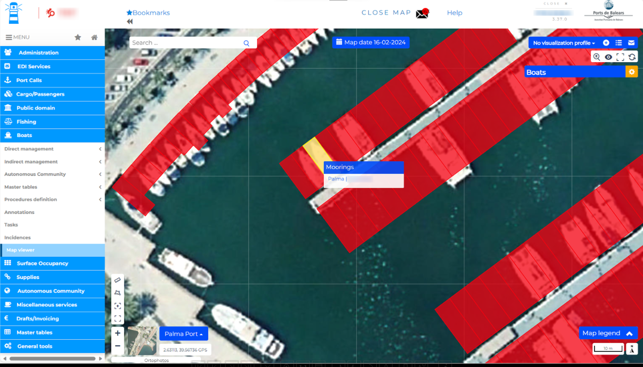
In collaboration with Ersi España and Prodevelop, the Balearic Islands Port Authority (APB) has implemented Geographic Information Systems (GIS) to manage information on the infrastructures and port operations in its five general interest ports more efficiently. The platform integrates the port authority's ICT systems, providing a standardised and comprehensive solution for managing assets, operations, and infrastructures.
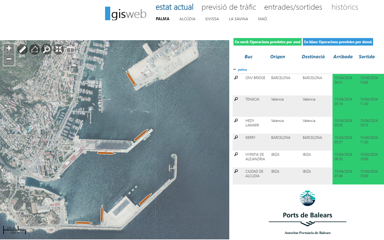
The APB handles an annual volume of more than 50,000 port calls, one of the highest in Spain. It also has one of the highest passenger traffic volumes, registering more than 2.4 million cruise passengers and six million scheduled passengers.
The rollout of the smart map systems will help to achieve an efficient and synchronised management of the data generated by port operations, concessions, tenders, asset and infrastructure management, fleets, port services, and port security, among other things. GIS also allow for real-time monitoring.
In addition, the integrated graphic management of the APB's assets will allow users to take advantage of the available information in order to optimise and streamline port processes, such as organising the public areas, recreational craft, ports of call, and supply networks.